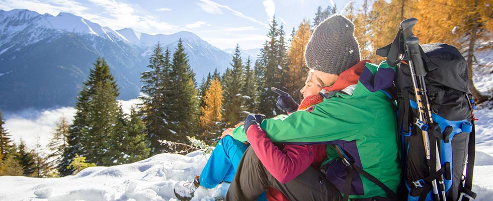
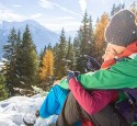
Our personal hiking suggestions
Böcksteiner Höhenweg : walking time about 1 1/4 hours
From the Böcksteiner federal road, opposite the bakery turn into the Blümelweg, then go along the marked way on the beautiful forestry way in the direction of Bad Gastein. In Bad Gastein you get out at the cascades torrent lining of the Palfner stream and you can take the bus to Böckstein at the Raika car park our you walk back the Elisabeth Promenade to Böckstein.
Knappenbäudelsee (2.238m): walking time about 3 hours
From Sportgastein into the direction of Talschluß. About 800 m to the south of the Genossenschaftshütte a small road leads approximately to the east (left) in the direction of the Brandtneralm, where near a striking wayside cross the "Peter Sika-Weg" begins. The way leads now partly steeply downhill, passing impressive remains of the still open gold mining and finally reaches - above the Weißbachtal - the picturesque Knappenbäudel Lake, in which the mountain peaks of the south west marking of the Naßfeld are reflecting. Further on you go into the direction of the Goldbergbahn, which you cross until the Blumenfeldköpfl, Hieronymushaus and then along the foresty way to the healing gallery.
Naßfeld (Sportgastein, 1.588 m): walking time about 2 hours
The starting point is at the bus station in Altböckstein, then go along the road to Sportgastein (about 300 m), turn right in front of the hotel cafe Evianquelle and walk along the old Nassfeldweg, passing the Astenalmen (alpine pastures - maybe you need a good break for a snack?) until you finally arrive in Sportgastein after having fantastic impressions of waterfalls, bridges and gorges. After visiting one of the several alpine huts, you can take the bus and return to Böckstein.
Bockhartseehütte (1.917m): walking time about 1 hour
From the Valeriehaus (Sportgastein) you take the road of the Bockart Lake Power Station until the old miners' houses. From there the marked footway leads to the Bockhart Lake. Before the last bend a steep track branches off, which winds its way up to the top. Enjoy the beautiful view and the chamois goulash.
Böckfeldalm: walking time about 45 minutes
Starting point is the car park at the hotel Rader, the way branches off and
leads you into a pleasant forest way with nice view points to the top. You
have several opportunities of admiring Böckstein and the opposite mountain panorama. At the Böckfeldalm you should not forget to try the self-made mountain cheese, the bread and the homemade doughnuts. Sometimes the landlord plays the Styria accordion or the guitar.
Over the Korntauern to Mallnitz (2.460 m):
walking time about 4 hours, Korntauern - Mallnitz about 3,5 hours
After the railway station Böckstein you go the road into the Anlauftal, after a walking time of about 75 min. the way leads over the stream (there is a sign) into the direction of Korntauern. The way partly zigzags to the top and gives you the most beautiful views on other summits. In former times this way was an important connection for the traders travelling from north to south. Follow the Alpenvereinsweg until the top of the pass of the Korntauern (2460 m). Then it goes into the southern direction until the Hannoverhaus (2772 m) to the Mindener hut (2428 m) without any food and service and to the Hagener hut (2446 m). After a strong meal in the hut you can walk over a nice alpineground until Mallnitz. By the Tauernschleuse or the train you have the possibility to return to Böckstein.
... only some of many possibilities!